A Map for Guiding Us in Remote Places That Will Revolutionize How Transmission Lines Operate

21 of December of 2020
Even though we still have paper maps, it’s hard to imagine daily life without looking up an address on an app or the computer. Technology and digitization are constantly improving our quality of life. What was unthinkable only a few years ago, like getting directions to anywhere via a device and moving freely on a virtual map, is now a reality that continues to evolve.
Apps like those developed by Google – Google Maps – or Bing – Bing Maps – have made it possible and accessible for all devices for years. However, it’s still difficult for these apps to display access and routes for remote locations outside of the usual roads they’ve already registered.
This information is especially valuable in terms of infrastructure construction and operation. Many of these structures are located in areas that are hard for operators and technicians in charge of construction, supervision, and maintenance to get to. This, in turn, makes working on them difficult.
That’s where the challenge we set for ourselves on the team comes into play. How can we provide this information? The Ferrovial Power Infrastructure team and the Innovation – Asset Management team have joined forces to work on a solution for storing and calculating access routes for assets in remote locations off the beaten track of the conventional map apps that we all know.
The result was a platform that will create a database of all the available routes for reaching remote infrastructure locations that are hard to get to. The itineraries for each specific activity in the area, like maintenance or resource management, will then be analyzed and optimized.
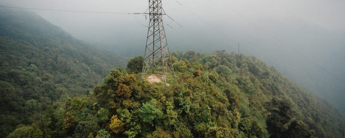
Thanks to this solution’s application for the Transchile transmission line managed by Ferrovial Power Infrastructure, we’re reducing travel time to these complicated locations by 30%, thus facilitating access to and work in the area.
How does it work?
This new system makes it possible to create new routes through both GPS and designs with orthophotos that combine aerial photography with the maps’ layouts.
Then, through a GIS (Geographic Information System) interface and geocoding, the application determines the optimal route for reaching remote locations.
To do this, it uses smartphones or other intelligent computing devices to analyze different variables like slope, road types, vehicle types, restrictions, real-time traffic… all to obtain an actual prediction of the route to take.
One of this system’s greatest innovations is that it can be integrated with all asset management software, offering an interconnected tool that gives the sector numerous advantages:
- It will create and store both public and private routes
- It will generate a record of inspections
- It will progressively improve access to infrastructures, making it possible to save and alter route parameters
- It will optimize planning and reduce the time needed for maintenance
- Its mobile app implementation will make adopting this system easier
- It will promote greater knowledge of the environment, including identifying inaccessible sections
- It will improve travel time in case of emergency or errors, where the response time is a crucial variable for teams
- It will improve teams’ logistics during the design and construction phases of projects, where many of the access roads to the site are temporary
Drone usage
We’re also exploring new solutions to improve asset management, such as using drones to inspect assets as with our pilot project in Transchile.
In short, we want this new system to implement many improvements in locating remote areas that are difficult to get to for all teams. That way, we can offer more innovative, efficient, digitized management for our infrastructure projects.


There are no comments yet