From Florence to Zaragoza: cities where we can still see how Roman cities were organized

17 of September of 2024
Before laying the foundation stone of a new city, the Romans consulted wild animals to see if the chosen site was the right one. Numerous writings relate how, following the Etruscan tradition, they dissected an animal – usually a bird – to examine its entrails. If their lungs and stomachs were sound, it confirmed that the air and water in the area were healthy and that people who settled there would be too.
Settlers were then ready to hold the first ceremony in honor of the future city. They paid homage to the gods and prayed that the future of the city would be successful and prosperous. But behind all these rites was an entire planning process that went beyond the symbolic. The Romans chose the location of cities taking into account access to water, soil quality, proximity to raw materials, and the possibility of establishing road networks with the rest of their territories.
Once the site was chosen, urban development began, which in many cities took the form of streets perfectly ordered by grids. In some cities, such as Florence, Merida and Zaragoza, the layout left by the Romans thousands of years ago can still be seen today. You just need to know where to search for it.
How were Roman cities organized?
Roman cities had a rectangular plan in which two streets took center stage: the Cardo and the Decumanus. The first crossed the city from north to south and the second from east to west. The rest of the narrower roads ran parallel to the two main roads, forming an orderly grid.
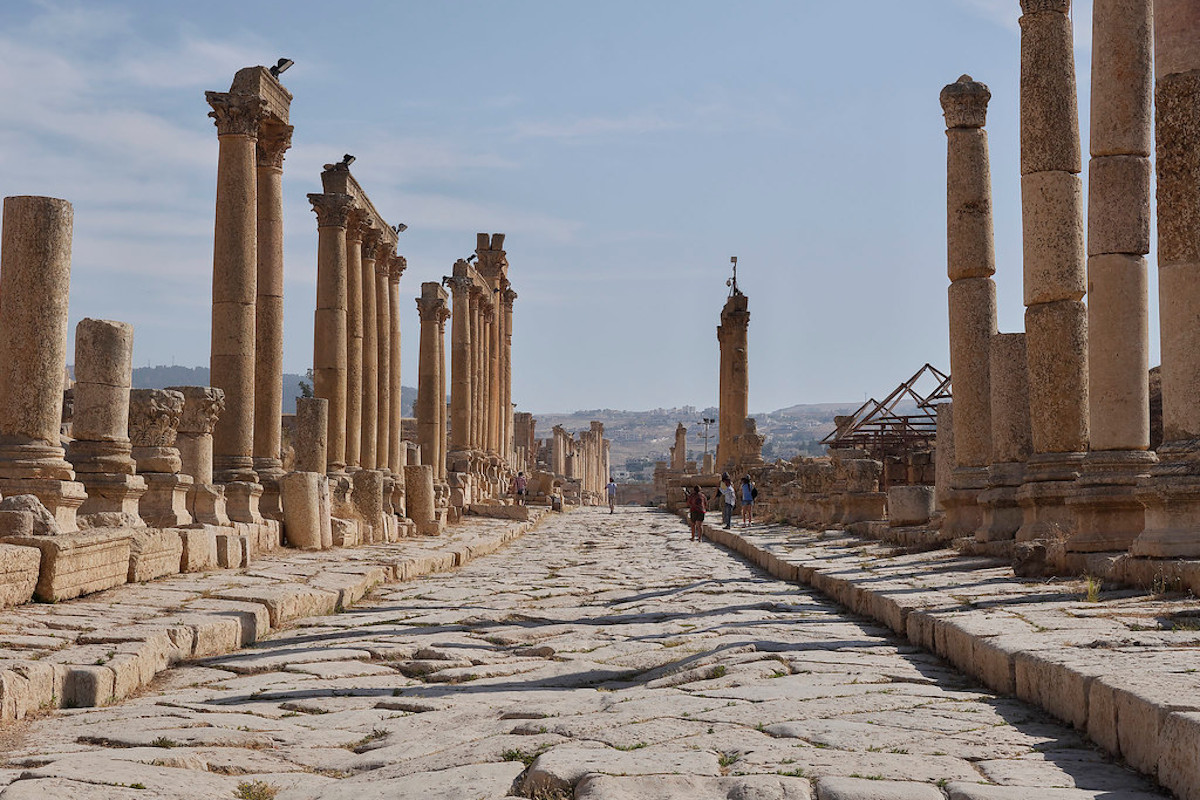
Remains of the Cardo in the Roman city of Gerasa, Jordan. Edgardo W. Olivera (Flickr)
At the point where the Cardo and Decumanus met was the forum, a large space where the main public buildings were located – the equivalent of the Greek agoras and an ancestor of our town squares. Although each city had its own characteristics and singularities, markets and buildings dedicated to leisure such as baths, circuses and theaters were often located in the vicinity of the forum.
Representation of the Roman city of Mediolanum (present-day Milan). Wikimedia Commons.
Another singularity of the Roman streets was that they were built with a small elevation in the center to facilitate the flow of water towards the sewage systems. These streets were usually paved and, in some cases, had raised block systems that had a function similar to that of crosswalks, allowing pedestrians to cross the street without having to go down to the roadway.
In which cities can you find a Roman grid?
This urban development of Roman cities took shape over centuries as the Romans expanded their territory and established military colonies and bases in their new provinces.
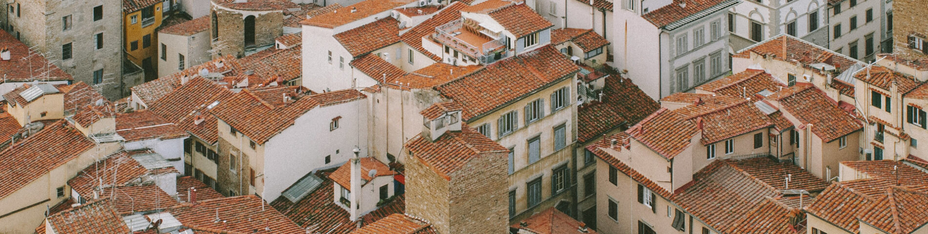
Today, historical records and archaeological remains make it possible to determine what the Roman layouts were like in many of today’s cities. A good example is Florence, a city that grew significantly during the Middle Ages and the Renaissance, but also retains traces of its Roman past.
Street in Florence. Sarah Sheedy (Unsplash)
The old town has a rectangular plan in which the Cardo and Decumanus, which intersect in Piazza della Repubblica, still survive. The succession of orderly, parallel streets in the historic center contrasts with many other European cities that grew during the Middle Ages, where the plan tends to be much more disorderly.
Another city in which the remains of a Roman plan can be seen is Mérida. Although the composition has changed substantially, the historic center is still organized in a fairly orderly succession of streets arranged in a grid. These streets lead to places and monuments that maintain their Roman past, such as the bridge over the Guadiana, the arch of Trajan, the theater and the amphitheater.
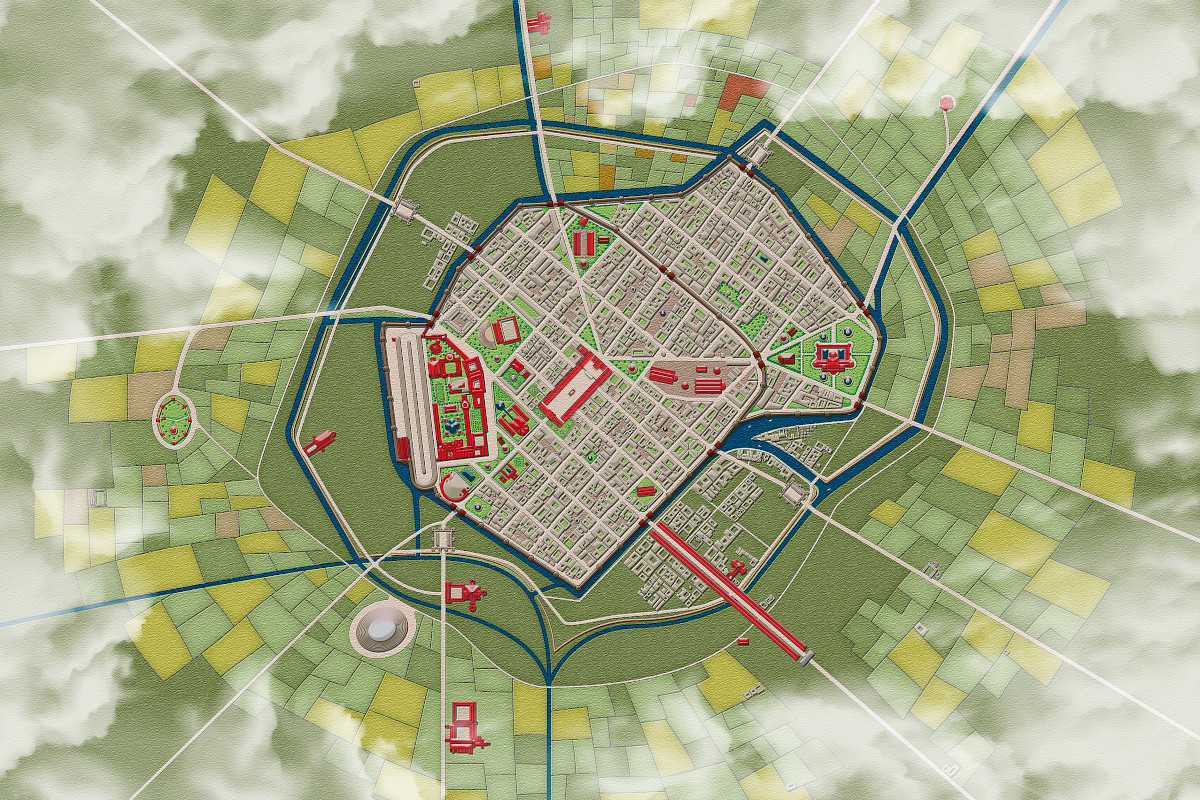
Zaragoza also stands out in the list of cities that maintain traces of Roman urban development. The ancient Caesaraugusta located its Cardo in what today is the area of Calle Don Jaime I, and its Decumanus in the surroundings of the Calle Mayor. In this way, the streets crossed the entire city from north to south and from east to west, connecting the gates of the city.
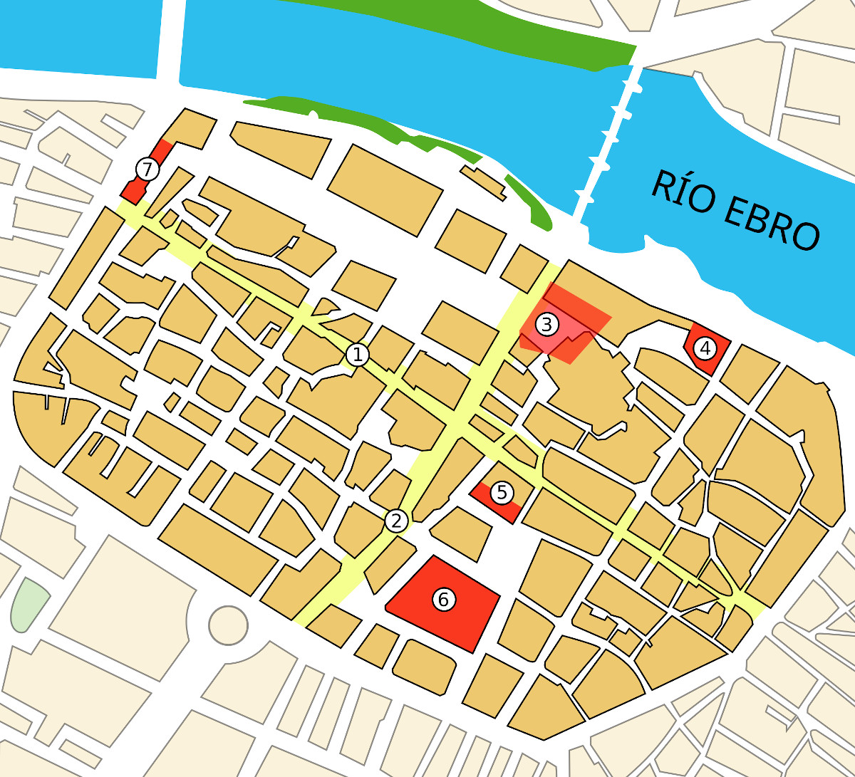
Map of the Roman city of Caesaraugusta over present-day Zaragoza. Wikimedia Commons.
And what about Rome? The truth is that the earliest Roman cities experienced organic, unplanned growth. A good example can be found in the Italian capital, which during its first years of history was formed in a chaotic and disorganized way around the hills and the Tiber River.
And, as the Roman Empire passed its heyday and began to experience its decline, cities adapted and changed to meet new challenges. One of the main new challenges was defense, with many cities with orderly organization needing to build walls and fortresses. History moved on and gave way to the Middle Ages, a period in which cities changed and adopted other forms of expansion – maintaining, in many cases, the legacy that the Romans had left on their soils and streets.


There are no comments yet