Forests millions of years ago and horizontal rain: all that remains hidden nearby the Los Tilos Bridge

28 of February of 2024
From the depths of the Atlantic to the highest point of the Roque de los Muchachos, at an altitude of more than 2,500 meters, the island of La Palma offers beaches, villages, waterfalls and forests that can only be visited after traveling kilometers and kilometers of winding roads. One of these roads, the one that leads to the northeast of the island, separates into two shortly after passing the El Tendal cave, where indigenous islanders lived for about a thousand years.
If you turn right, the road approaches the coast to pass through the town of San Andrés. If you go straight ahead, the road continues north and passes through the Los Tilos Bridge, the great viaduct spanning over 350 meters and supported on a single concrete arch, one of the largest of its kind in the world.
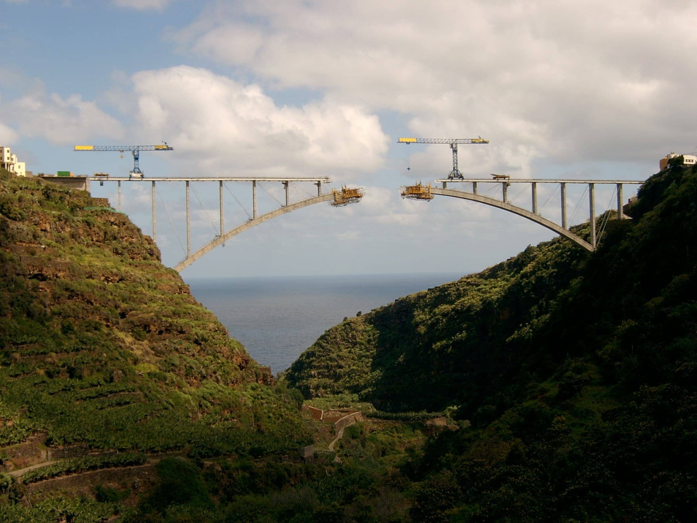
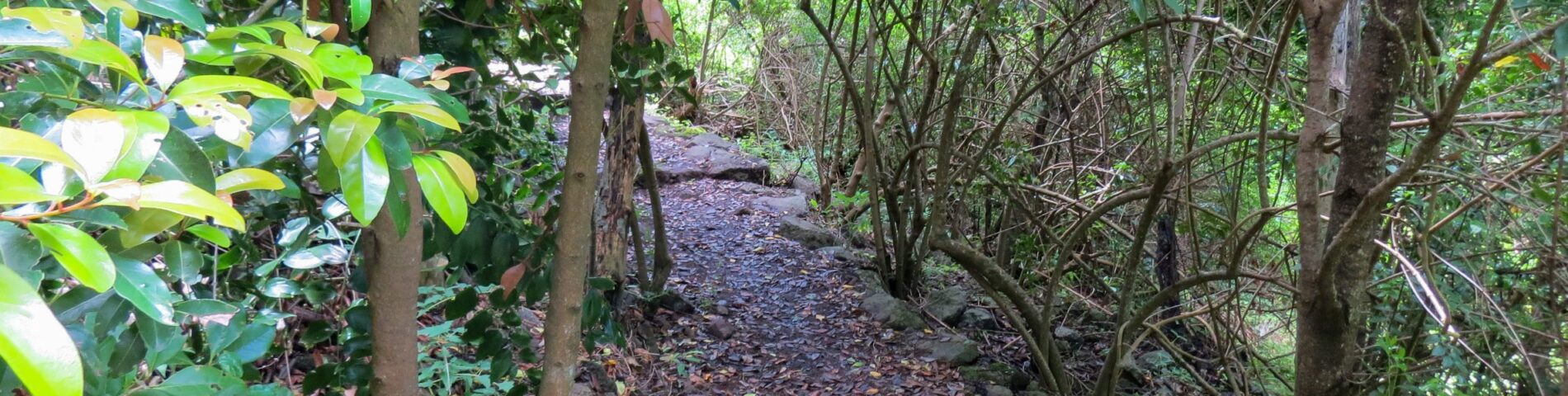
This bridge, one of Ferrovial’s most iconic works of engineering, rests on the slopes of the great Barranco del Agua ravine. When crossing it, one inevitably gazes around to enjoy the steep and impossible orography of a ravine that meanders outwards from the interior of the island and that hosts unique ecosystems and landscapes.
A journey into the past
Ravines are one of the most distinctive elements of the Canary Islands, volcanic islands that emerged from the sea some 30 million years ago. Over the course of history, rainwater has run off from the highest reaches of the islands, eroding the terrain and shaping these geographic features until reaching the sea.
In the northeast of La Palma, the greenest island of the archipelago, ravines carry rainwater from the slopes of the Caldera de Taburiente to the Atlantic Ocean. Along the way is a succession of springs such as the Marcos and Cordero springs and waterfalls such as the Los Tilos waterfall, all surrounded by lush vegetation.
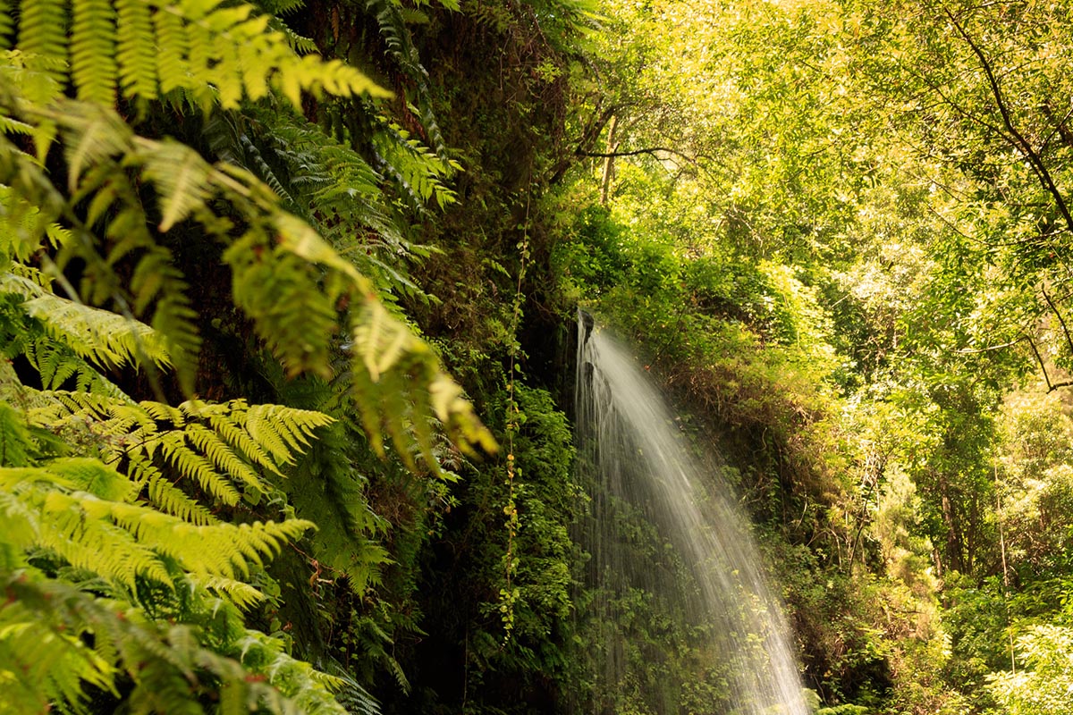
Los Tilos waterfall. Roberto Steinert (Flickr)
Next to the Barranco del Agua ravine, we also find the Los Tilos forest, a place that allows us to travel back in history. A first brief stop takes us back to 1983, when this place became the first World Biosphere Reserve of the Canary Islands. The second stop takes us back much further to the world of more than 20 million years ago, when laurel forests extended over a wide area of southern Europe and northern Africa.
At the time, this rainforest was disappearing due to successive glaciations and other climatic changes. The forest gradually moved towards more temperate regions until, today, its extension has been reduced to the Macaronesian archipelagos. On islands such as La Palma it has evolved very little since then, so its vegetation is a living image of the great forests of the past.
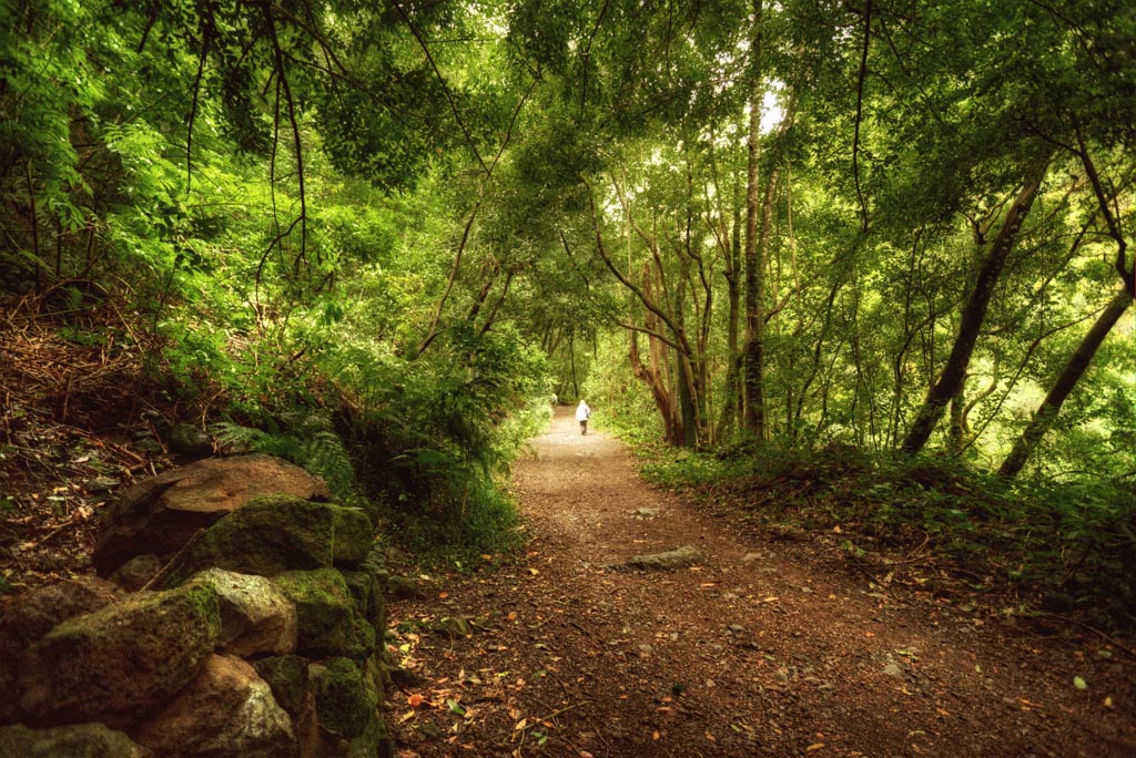
Walking track in the Los Tilos forest. Jose Maria Cuellar (Flickr).
The Los Tilos forest, with trees standing up to 30 meters high, is one of the largest laurel forests in the world. This forest remains here today thanks to the humidity brought from the sea by the trade winds and the island’s mild temperatures. The forest is host to all kinds of plant species, such as lindens, laurels, strawberry trees, heather and the incredible giant ferns. Fauna includes endemic birds such as the Bolle’s pigeon, the Laurel pigeon, and the gray wagtail.
The bridge over the ravine
If you follow the path that marked by the ravine, leaving the laurel forest behind, you end up passing under the bridge of Los Tilos. At that point, the ravine becomes very deep and the slopes very steep. The one on the south side forms a practically vertical cliff about 150 meters deep. At its base, the distance between the two slopes is about 105 meters. At its highest point, it reaches 290 meters.
The bridge, which is 353 meters long and has a span of 225 meters, rests on these two slopes. This is one of the largest bridges in the world of its kind. It stands out for the way in which the arch transmits weight to maintain itself upright and adapt to its environment. At its height, as from so many other points on the island, it is possible to see the horizontal rain (or sea of clouds) that occurs when the trade winds push the clouds against the mountains.
Under the bridge, crops and dwellings begin to follow one after the other. Further on, after having traveled several kilometers across the island, the water ravine finally ends in the sea. Its end coincides with San Andrés, one of the oldest and most historic towns of the so-called “isla bonita” (beautiful island). Throughout history, this town has lived with the water that arrives, only seasonally, from the highest points of the mountain.


1 comment
transformational gangstas
04 of June of 2024
Dwelling into the past depression is such a dangerous part for any human being. Thus many circumstances are not in our hand or in control. We may need to take over the control of mind, and has to Break free from the ordinary, connect with your authentic spirit, and discover both peace and prosperity in your business and your life with Business, Leadership and Transformational Change Management Coaching. All these services are offered by Transformational Gangstas (https://transformationalgangstas.com/).