A Traffic Simulation that Shows How Small Changes Impact Vehicles and Pedestrians

09 of March of 2020
Some games are more than just entertainment. Such is the case with A/B Street, an idea Dustin Carlino came up with as a way to try to improve real traffic on the streets of Seattle (United States). But what started out as a “realistic game” has grown to become a more significant project, and best of all: it can suit any city in the world.
The game’s A/B prefix is no accident. In the technique known as “A/B testing,” two options to address a problem are tested, and the one that offers the best result is chosen. The typical example used for designing an app or a website is the color of a button – for instance, the “buy” button in a store. The test is run with green and blue hues, which are each shown 50% of the time to actual users while the store is in operation.
If, after some time, it can be seen that 10% of visitors with the A button click it, but only 5% with B, option A is clearly preferable since color was the only factor that changed. There is an entire mathematical setup for knowing when the data is truly significant and how many tests are required. On the internet, the tests that Yahoo, Amazon, and Google have run in this regard are legendary: since there are so many people visiting their websites every minute, they can get highly significant data in just a few hours and reach a clear answer.
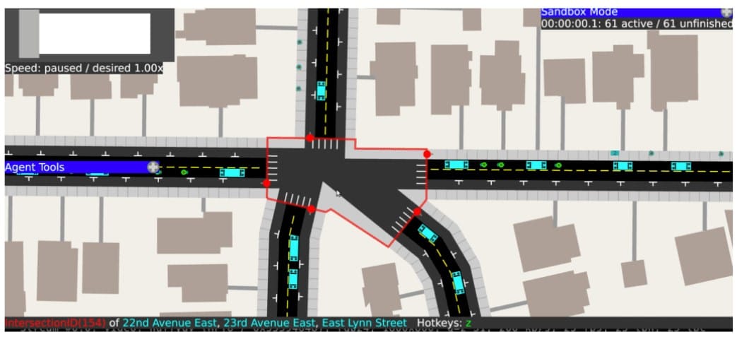
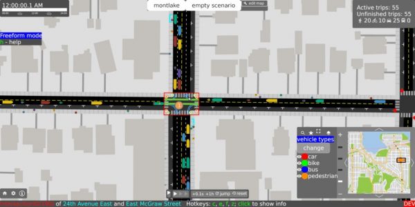
As for A/B Street, the same can be done with city traffic. The game is laid out on an actual street map of Seattle, with its many lanes, intersections, and traffic lights. Every lane is exquisitely detailed, for cars as well as bus lanes and even bike lanes. The red lights are operated as close to reality as possible, as are the parking spaces. And pedestrians almost behave like actual people: they come out of buildings, go to just about the closest car, drive, arrive at their destination, and park again.
All the ways to improve the city
The city of A/B Street is almost a living being that behaves quite realistically; in part, it uses the PSRC mathematical model created by transportation experts, which has been used in planning other cities.
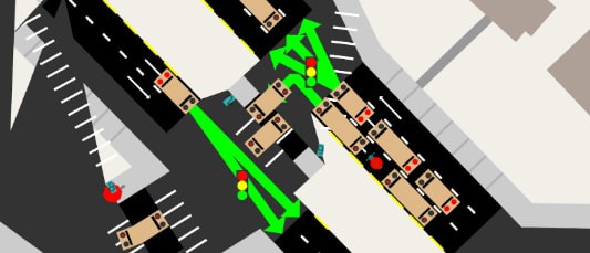
In “game mode,” bus lanes can be added or removed, parking spaces can be taken out, and the length of traffic lights can be changed. What would happen if one car lane were replaced with a bike lane? When the simulation is resumed, the changes can be observed, which is much easier in the “A/B view” mode, where both versions can be compared at once.
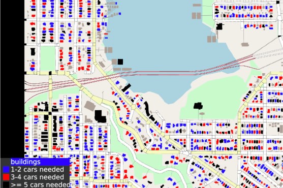
The statistical panels, which show information like the number of completed trips (on foot, by public transportation, or by car) or those left to be completed, also help. Here the so-called “utility functions” come into play, which show objectives that are achieved: shorter, faster trips; less pollution; or a shorter average commute.
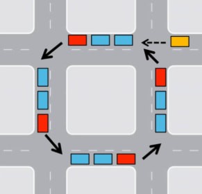
Other more radical options include testing changing the direction of traffic on some streets, or adding or removing stop signs. Special modes of transportation were added in the most recent release, and others, such as shared rental cars and light-rail trains, are in the works. They’ve also considered exploring ideas like superblocks, a road traffic concept that encompasses several neighborhood blocks and has already been tested in the city of Barcelona.
Space for experimentation
Street A/B’s code is open-source, so anyone can download it, check it out, and make it better. Even though it was made for the city of Seattle, there is a developer’s guide that explains how to make the modifications needed to adapt it to other cities. Map information comes from OpenStreetMap, a map similar to Google Maps but which has an open license, whose cartographical information may also be downloaded and used freely. So it wouldn’t be unusual for us to see versions of this project for other cities based on this software in the future.
As the game’s creator says, it would be wonderful if anyone could notice small changes that had a real impact on the way vehicles and pedestrians move around cities all over the world. In fact, it’s not impossible to imagine that they could even show this to city leaders in a clearly visible way for their consideration. Sometimes, big ideas come from little amusements like this one, and they end up going much further than ever planned.


There are no comments yet